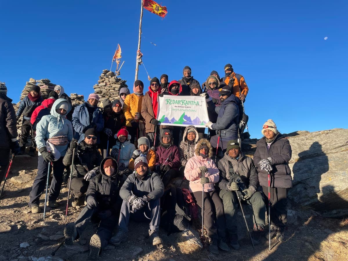

Highlight
Camp on vast Ali Bugyal and Bedni Bugyal meadows
Panoramic views of Trishul, Nanda Ghunti and Chaukhamba
Moderate grade — no technical climbing required
Ali Bedni Bugyal Trek
Twin alpine meadows of Garhwal
Walk through Ali and Bedni — two of the largest high-altitude meadows in Uttarakhand — with Trishul and Nanda Ghunti as your backdrop.
The Ali Bedni Bugyal trek is a classic Garhwal route through rolling alpine pastures.
Without pushing to Roopkund’s high pass, this trek focuses on the meadow experience — perfect for trekkers who want big Himalayan scenery at a Moderate grade in the September–November window.
The route runs Rishikesh to Rishikesh, covering 30 km across 6 days with a highest point of 12,500 ft. It is graded moderate, which makes it a strong fit for travellers who are comfortable walking a full day but do not need prior technical experience.
Departures run in fixed monthly batches of 6-15 persons, led by certified trip captains carrying a first-aid kit and oxygen on the high sections. The best window is September - November.
Why travellers love it
Day wise plan
A complete day-wise plan for Ali Bedni Bugyal Trek covering drives, trail sections, altitude gain, meals, and overnight stays from start to finish.
Drive to Lohajung via Karnaprayag.
Begin trek through mixed forest and village trails.
Climb to Ali Bugyal — one of India’s finest alpine meadows.
Traverse rolling meadows with continuous Himalayan views.
Descend via Wan village back to Lohajung.
Drive back to Rishikesh; trip concludes.
Itinerary route map
Day-by-day route map for Ali Bedni Bugyal Trek. Select a day to view trail allocation, altitude, and distance.
Verified coordinates for this trek are not yet mapped.
Itinerary and altitude chart remain available below.
Text route list (accessible alternative to the map)
Elevation profile
Distance-based altitude chart for Ali Bedni Bugyal Trek using verified trek segment distances. Hover or drag across the profile to explore each stage.
| Day | Location | Altitude | Distance | Duration | Δ from prev. |
|---|---|---|---|---|---|
| Day 1 | Lohajung | — | — | 9-10 hrs drive | — |
| Day 2 | Didna Village | 8,500 ft | 8 km | 5-6 hrs | — |
| Day 3 | Ali Bugyal | 11,000 ft | 10 km | 6-7 hrs | +2,500 ft |
| Day 4 | Bedni Bugyal | 11,500 ft | 8 km | 5-6 hrs | +500 ft |
| Day 5 | Lohajung | — | 12 km | 6-7 hrs | — |
| Day 6 | Rishikesh | — | — | 9-10 hrs drive | — |


Inclusion & exclusion
A detailed overview of everything included in your Ali Bedni Bugyal Trek package — stays, meals, permits, transport, and trek support — along with the costs you should plan for separately.
Inclusions
Exclusions
- Bag offloading is charged at ₹1,600 per bag.
- Maximum weight per offloaded bag should not exceed 10 kg.
- All package prices are quoted before 5% GST.
Safety Precautions and Protocols
Essential safety measures for Ali Bedni Bugyal Trek — from acclimatization to weather awareness and emergency protocols.
Acclimatization
- Spend time at the base camp or starting point before ascending
- Follow “climb high, sleep low” with short acclimatization hikes
- Walk slowly; report headache, nausea, or dizziness to your trek leader immediately
Weather preparedness
- Check the forecast; delay if heavy rain, snowfall, or storms are predicted
- Carry waterproof jacket, poncho, and rain cover for your pack
- Start early; reach camp before afternoon weather shifts
Hydration and nutrition
- Drink regularly even when you do not feel thirsty
- Eat balanced meals; carry energy snacks for long trail days
- Avoid alcohol at altitude — it worsens dehydration and acclimatization
Emergency protocols
- Stay with your group and follow trek leader instructions at all times
- Carry personal medications and share medical history with your leader
- Indian Treks carries a first-aid kit; serious cases are evacuated per itinerary plan
Delicious & Nutritious Food During Trek
Fresh, high-altitude meals designed for energy and warmth on Ali Bedni Bugyal Trek — breakfast, lunch, evening snacks, and dinner prepared by experienced cooks.
Breakfast
- Beverages: ginger/masala tea, coffee, juice
- Indian: paratha, poha, porridge, omelettes, upma
- Light options: sandwiches, jam and butter
Lunch & dinner
- Fresh roti, seasonal vegetable sabzi, dal, rice, and paneer dishes
- Hot soup and snacks on arrival at camp
- Vegetarian meals standard; inform us of dietary restrictions at booking
Trail snacks
- Energy bars, dry fruits, and packed lunch on long walking days
- Electrolyte sachets recommended — carry your preferred brand
- Plenty of safe drinking water at camps; refill bottles each morning
Best Time to Visit Ali Bedni Bugyal Trek
Ali Bedni Bugyal Trek runs best during September - November. Timing changes the trail conditions, the views, and how busy the route feels, so here is what to expect across the year.
September - November: Peak Season
This is the window Ali Bedni Bugyal Trek is built around. Trails are at their best, campsites are fully operational, and departures run every month with the largest choice of dates.
- Daytime temperature: 10°C – 15°C
- Night temperature: 4°C – 10°C
- Rainfall: frequent — expect rain most days and slippery trails
- Crowds: high on weekends, quieter on weekday batches
Shoulder Season: Fewer Crowds
Just before and after the September - November window the route stays open but the groups are smaller. Conditions are slightly less predictable, and the reward is a much quieter trail.
- Daytime temperature: 10°C – 18°C
- Night temperature: 2°C – 8°C
- Rainfall: light and infrequent
- Crowds: low to moderate
Off Season: Limited Access
Outside the main window the higher sections can be blocked by snow, monsoon damage, or forest department closures. Departures are paused and we recommend planning inside the September - November window instead.
- Trail access: partial or closed on the upper route
- Views: can be excellent on clear days
- Support: limited stays and transport near the base
- Crowds: very low
Things to Carry
Pack for two realities — warm sunshine at the base and cold nights at 12,500 ft. Keep your pack under 10 kg; anything heavier compounds fatigue on long trail days.
Clothing
- Base layer: 2 sets moisture-wicking thermals (top and bottom)
- Mid layer: Fleece jacket + down insulated jacket (600-fill or higher)
- Outer shell: Windproof, waterproof rain jacket with hood
- Trekking trousers: 2 pairs, quick-dry (never jeans)
- Rain pants or poncho for wet conditions
- Warm hat/beanie + cap with brim (sun protection)
- Gloves: waterproof outer gloves
- Neck gaiter / buff
- Trekking socks: 4-5 pairs (merino wool preferred)
- Camp footwear: light sandals or Crocs for evenings
Footwear
- Trekking boots: mid-to-high ankle, waterproof, broken in before the trek
- Gaiters to keep boots dry on snow and wet trails
- Extra pair of insoles in case your boots get wet inside
Equipment


How to Reach Ali Bedni Bugyal Trek Base Camp
Ali Bedni Bugyal Trek starts from Rishikesh, reached through a multi-stage journey. Plan to arrive a night before your batch reporting time.
Reach Rishikesh
Nearest airport is Jolly Grant, Dehradun for Uttarakhand routes and Bhuntar, Kullu for Himachal routes. Taxis are available at both.
Haridwar, Dehradun, and Chandigarh are the closest well-connected railheads, each with onward buses and taxis.
Overnight buses and private cabs connect Delhi and nearby cities to Rishikesh. Book the earliest arrival so you reach before the reporting time.
Rishikesh to Rishikesh
Rishikesh to Rishikesh through the main highway and hill roads.
Typically 7–11 hours depending on traffic, weather, and road conditions.
Shared taxi, private cab, or the operator-arranged Tempo Traveller included in your package.
Withdraw cash and download offline maps at the last major town — connectivity beyond the base is unreliable.
Rishikesh to the trailhead
A short local transfer brings you from Rishikesh to the official starting point.
Reach the base a night before departure so the team can complete document checks and a fitness briefing.
From here you cover 30 km over 6 days, topping out at 12,500 ft.
Policy
Booking, cancellation, refund, and participation terms so you know exactly where you stand before joining Ali Bedni Bugyal Trek.
| Policy Point | Details |
|---|---|
| Booking Confirmation | Your seat is considered confirmed only after the required advance payment is received. |
| Balance Payment | The remaining amount must be cleared before departure or as per the reporting instructions shared by the team. |
| Transport Selection | Pickup from the base city is applicable only if that option is selected at the time of booking. |
| ID Requirement | Every participant should carry a valid government photo ID for verification and trek administration. |
| Operational Changes | In case of weather, road, or safety concerns, the itinerary may be adjusted for the well-being of the group. |
Departures and route decisions remain subject to weather, road access, local administration, and safety conditions. Final operational calls are always taken in the interest of the group.
FAQ's
Common questions about Ali Bedni Bugyal Trek — difficulty, altitude, fitness, permits, stays, and what to expect on the trail.
Same meadow approach but stops at Bedni Bugyal — no high pass crossing to the lake. Moderate grade, lower maximum altitude.
September to November — meadows are golden, skies are clear, and trails are stable before winter.
Why Ali Bedni Bugyal Trek with Indian Treks
Trusted Himalayan operator for treks across Uttarakhand, Himachal, Nepal, and Kashmir — safety-first teams, transparent pricing, and trekkers who return season after season.
Camp on vast Ali Bugyal and Bedni Bugyal meadows
Panoramic views of Trishul, Nanda Ghunti and Chaukhamba
Moderate grade — no technical climbing required
Rich Garhwali village culture en route
What you can expect


Rental gear for this trek


Rentals are collected at the base camp and returned at the end of the trek. Pick a size to reserve kit for this departure.