Highlight
Snow-covered forests and alpine meadows
Bekaltal & Brahmatal high-altitude lakes
Views of Mt. Trishul and Mt. Nanda Ghunti
Brahmatal Trek
Winter lake trek of Garhwal
A winter journey through forests, meadows and frozen lakes in the Garhwal Himalayas — Easy to Moderate, base camp Lohajung.
Brahmatal is one of the most scenic winter trekking destinations in Chamoli, Uttarakhand.
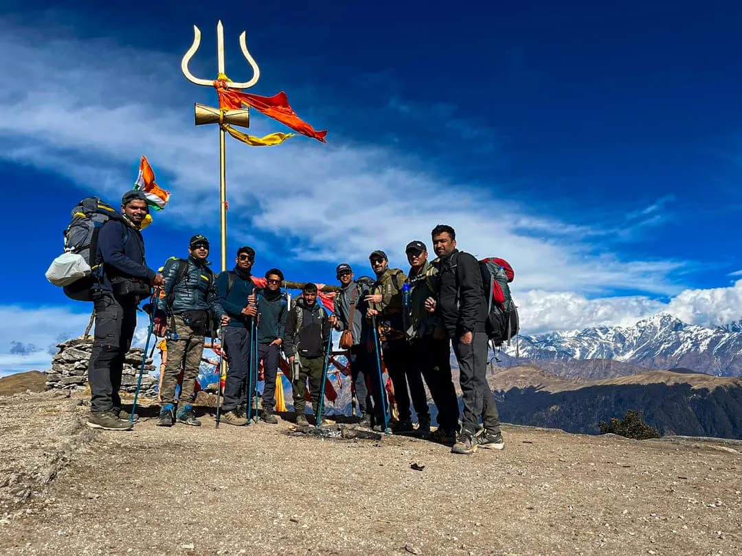
From Lohajung the trail winds through oak and rhododendron forests to Bekaltal and Brahmatal Lake, then opens onto snow meadows and ridgelines with views of Mt. Trishul and Mt. Nanda Ghunti — subject to weather and visibility.
Brahmatal Trek: A Winter Journey Through Forests, Meadows & Frozen Lakes
- Altitude: 12,150 ft
- Duration: 6 Days
- Trek Distance: Approx. 25 km
- Base Camp: Lohajung
- Trek Difficulty: Easy to Moderate

Walk oak–rhododendron forests to Bekaltal and Brahmatal Lake, with views of Mt. Trishul and Nanda Ghunti — with Indian Treks.
Brahmatal is one of the most scenic winter trekking destinations in the Garhwal Himalayas, offering a beautiful combination of dense Himalayan forests, open alpine meadows, frozen lakes and spectacular mountain views. Located in the Chamoli region of Uttarakhand, the trek takes you deep into a landscape that changes dramatically with altitude and season.
The journey begins from Lohajung, a small mountain village that serves as the base for the trek. From here, the trail gradually enters forests dominated by oak and rhododendron, with sections of the route opening into expansive meadows and ridgelines. During the winter months, snowfall transforms these forests and meadows into a beautiful white landscape, making Brahmatal particularly popular among trekkers looking for a Himalayan winter experience.
One of the defining features of the trek is its combination of Brahmatal Lake and Bekaltal. These high-altitude lakes become especially atmospheric during winter when the surrounding landscape is covered in snow. The trail leading towards them passes through quiet forests and open clearings, creating a gradual transition from the lower Himalayan landscape to the snow-covered terrain at higher elevations.
The Mythology Behind Brahmatal
Brahmatal is associated with Lord Brahma, and local traditions connect the lake with meditation and spiritual significance. According to popular belief, Lord Brahma meditated at this location, giving the lake and the surrounding region their name.
Like many Himalayan destinations, Brahmatal combines natural beauty with stories and traditions that have been passed down through generations. These legends add another dimension to the trek, making the journey more than simply a walk through the mountains.
Why travellers love it
Day wise plan
A complete day-wise plan for Brahmatal Trek covering drives, trail sections, altitude gain, meals, and overnight stays from start to finish.
Distance: ~250 km · Time: 10–12 hrs · Pickup: ISBT Rishikesh, 6:15 AM · Overnight: Lohajung guesthouse · Altitude on arrival: ~7,600 ft.
Rishikesh is the starting point of the adventure. You will be picked up by our transport manager at the ISBT in Rishikesh at 6:15 in the morning, and from there you will be driven to Lohajung — the mountain settlement that serves as the base for the Brahmatal climb.
About 250 kilometres separate Lohajung (Chamoli district, Uttarakhand) from Rishikesh. The journey typically takes 10–12 hours, depending on traffic and road conditions. Indian Treks arranges Bolero, Tata Sumo, or Tempo Traveller vehicles for the transfer to Lohajung. On arrival you are assigned a room in the guesthouse.
You travel through mountain roads as you leave Rishikesh. If the weather is clear, you may glimpse the Garhwal Himalayas in the distance. The River Ganga keeps you company while you take in the serene scenery.
Along the highway you pass three of the most important holy confluences in the region — Devprayag, Rudraprayag, and Karnaprayag.
At Devprayag, the Alaknanda meets the Bhagirathi for the first time. On a clear day you can make out the different shades of teal and turquoise where the two rivers join.
Continuing through Srinagar (Garhwal), you reach Rudraprayag — the confluence of the Mandakini and the Alaknanda. About 33 km further along the road you arrive at Karnaprayag, where the Pindar joins the Alaknanda.
From Karnaprayag the road turns toward Tharali and Deval before the final climb into Lohajung. As you ascend, the majestic Nanda Ghunti massif often comes into striking proximity. If you reach Lohajung before dusk, you may catch a sunset painting the ridges in warm hues.
Local legend gives the settlement its name: villagers say the goddess Parvati fought the demon Lohasur in a “jung” (war) here — hence “Lohajung.”
Lohajung has a small market where you can pick up camping essentials and last-minute trek supplies. Sitting high on a ridge, evenings can be brisk; depending on the season it may also be cloudy or wet. Pack layers so you can adjust to changing temperatures through the day.
Overnight stay in a guesthouse at Lohajung. Trek briefing with the Indian Treks team.
Distance: 6 km trek · Time: ~5 hrs · Altitude: ~7,600 ft → ~9,800 ft · Overnight: Twin-sharing tents at Bekaltal campsite.
Today is the first walking day. After breakfast at Lohajung, the group sets out toward Bekaltal — a gentle, well-marked ascent of about six kilometres through oak, fir, cedar and rhododendron forest.
On clear stretches you are treated to stunning views of Mount Nanda Ghunti. After a short walk you reach Mandoli (Mundoli), the first mountain village on the route, which appears on your left as the trail continues.
The path gradually ascends across the ridges, winding and bending as it gains height. From open sections you can look toward the Kali Valley, where the Kali and Pindar rivers meet far below.
Beyond Mandoli the trail enters denser woodland. In spring and late winter, rhododendron blossoms bring colour to the mountainsides; in peak winter the same path can be completely covered in snow. The scent of cut wood and forest undergrowth is one of the day’s most memorable details.
After roughly two hours you reach a wooden bridge about ten metres long spanning a creek (Link-gaad). Water may need to be rationed at this source depending on the season. Crossing the bridge brings you to Begum — a serene clearing and an ideal rest stop, with views of Navali and Bagdi Bugyal and Nanda Ghunti still dominating the skyline.
Continue for about twenty minutes past two neighbouring streams to Gujreni. Some groups camp here, but Indian Treks continues to Bekaltal. Gujreni is excellent for birdwatching — look for species such as the Asian Barred Owlet, woodpeckers, Solitary Snipe and Blue-fronted Redstarts.
The final stretch is the last push of the day. About an hour and a half of forest walking brings you near Bekaltal Lake; the campsite sits roughly fifteen minutes from the water. After pitching twin-sharing tents, rest, then visit the lake later in the day.
Bekaltal sits in a thick oak grove. Its waters keep a distinctive dark-brown tint from organic matter leaching into the lake. In cold weather a thin film of ice may form on the surface. After a sunset at the lake, return to camp for a hot dinner and overnight in tents.
Distance: 7 km trek · Time: ~5–7 hrs · Altitude: ~9,800 ft → ~10,450–11,250 ft · Overnight: Twin-sharing tents at Brahmatal / Khabekhal.
Utilize the snowy pathways to your advantage as you make your way from Bekaltal toward Brahmatal. Depending on snow and trail conditions, the walk typically takes about four to seven hours.
The path winds through oak and rhododendron forest before opening onto the ridge meadows of Telindi (Tilandi) Top. From here you are rewarded with beautiful Himalayan views when the weather is clear — a highlight of the day.
Stay on the trail beyond Telindi; a gradual approach brings you to Brahmatal Lake, also known locally as Khabekhal. Twin-sharing tents are pitched near the lake for the night. Rest, enjoy a hot meal, and take in the quiet alpine setting around camp.
Distance: ~12 km trek · Time: ~8–9 hrs · Altitude: Brahmatal camp → ~12,150 ft (summit) → Daldum camp (~9,350–10,000 ft) · Overnight: Twin-sharing tents at Daldum.
After breakfast, prepare for the ascent to Brahmatal Top — the most visually striking day of the trek. The route climbs over Chota Jhandidar and Bada Jhandidar on an exposed ridge trail with valleys dropping away on either side. Sections can feel committing in snow or wind; follow your trek leader closely.
It typically takes about two and a half to three hours to reach Brahmatal Top. Pause here for magnificent views of the snow-capped Himalayan ranges. Mount Trishul stands close by, with Nanda Ghunti (Nandhaghunti) also commanding the skyline when visibility is clear.
From the summit, continue toward the next campsite at Daldum. The descent through forest usually takes up to about three hours and covers roughly 2.7 km on this final leg — slower when the trail is snowy or slippery. Oak and rhododendron woodland accompany you most of the way down.
Arrive Daldum by afternoon or early evening, pitch twin-sharing tents, enjoy a hot dinner, and rest overnight.
Distance: 4 km trek · Time: ~3–5 hrs · Altitude: Daldum → ~7,600 ft (Lohajung) · Overnight: Lohajung guesthouse.
From Daldum, take the left fork toward Lohajung. It is a short hike of about four kilometres and usually takes three to five hours depending on snow and pace.
The well-marked path crosses a few streams and continues through the same oak and rhododendron forest you walked earlier in the trek. As you move through the trees you will pass shepherd’s huts used by locals to shelter livestock.
From there, follow the stone-paved path that links the mountain settlements with Lohajung. Arrive at the village, freshen up at the guesthouse, and spend the later evening exploring the small town.
Sunsets from Lohajung are often breathtaking — a last look at the ridges before you leave. If you want mementos from the expedition, pick them up in the local market. The guesthouse serves a hearty meal; rest well overnight. Tomorrow you drive back to Rishikesh.
Distance: ~210–250 km drive · Time: 10–12 hrs · Drop: Rishikesh (ETA around 7:00 PM, traffic-dependent) · Meals: Breakfast.
As this incredible trip draws to a close, we bring you back to Rishikesh today. After your last morning tea and breakfast with the crew, the group departs Lohajung toward Rishikesh.
The road distance is typically about 210–250 km and takes around 10–12 hours, following the same corridor you travelled on Day 1 — Deval, Tharali, Karnaprayag, Rudraprayag, Srinagar (Garhwal) and Devprayag.
Arrival in Rishikesh is usually expected around 7:00 in the evening, though exact timing can change with route conditions and traffic. The Brahmatal trek concludes on drop at Rishikesh.
Itinerary route map
6-day Brahmatal — Day 1 Rishikesh → Lohajung; Day 2 Lohajung → Bekaltal; Day 3 Bekaltal → Brahmatal; Day 4 Summit → Daldum; Day 5 Daldum → Lohajung; Day 6 Lohajung → Rishikesh via Prayags.
Text route list (accessible alternative to the map)
Elevation profile
Distance-based altitude chart for Brahmatal Trek using verified trek segment distances. Hover or drag across the profile to explore each stage.
| Day | Location | Altitude | Distance | Duration | Δ from prev. |
|---|---|---|---|---|---|
| Day 1 | Lohajung | 7,600 ft (Lohajung) | ~250 km drive | 10–12 hrs | — |
| Day 2 | Bekaltal | 9,800 ft (Bekaltal) | 6 km trek | ~5 hrs | +2,200 ft |
| Day 3 | Brahmatal Lake | 11,250 ft (Brahmatal) | 7 km trek | ~5–7 hrs | +1,450 ft |
| Day 4 | Brahmatal Top → Daldum | 12,150 ft (summit) → Daldum | 12 km trek | ~8–9 hrs | +900 ft |
| Day 5 | Lohajung | 7,600 ft (Lohajung) | 4 km trek | ~3–5 hrs | -4,550 ft |
| Day 6 | Rishikesh | ~2,100 ft (Rishikesh) | ~210–250 km drive | 10–12 hrs | -5,500 ft |



Inclusion & exclusion
A detailed overview of everything included in your Brahmatal Trek package — stays, meals, permits, transport, and trek support — along with the costs you should plan for separately.
Inclusions
Exclusions
- Bag offloading is charged at ₹1,600 per bag.
- Maximum weight per offloaded bag should not exceed 10 kg.
- All package prices are quoted before 5% GST.
Safety Precautions for the Brahmatal Trek
Points to remember for safety on the trek:
- Arrive at the starting point of the hike in the best possible physical condition and readiness.
- The hike is not tough; if you keep both your feet and your mind calm and strong, you will find the journey rather simple.
- When you are out on the trail, remember that you may not always be beside your guide and that you must stay on the correct path.
- Avoid constantly looking around while walking in a way that unsettles your footing — focus on a steady, confident pace so your legs stay stable through the day.
- See your physician if you have any health concerns before joining the trek.
- Carry your personal medical supplies with you at all times — this is of the utmost importance.
How Indian Treks supports you on the trail
- Indian Treks carries a fully stocked first-aid kit at all times, including oxygen cylinders and medications that may be required during the trek.
- If a trekker faces serious difficulty, a stretcher is used to evacuate them back toward base camp when needed.
- On the Brahmatal Trek, camps are situated close to the tree line, which helps you stay in a more oxygen-friendly environment overnight.
- In a medical emergency, seek assistance immediately from your guide or another trekker who is trained to help.
Delicious & Nutritious Food During Trek
Fresh, high-altitude meals designed for energy and warmth on Brahmatal Trek — breakfast, lunch, evening snacks, and dinner prepared by experienced cooks.
Breakfast
- Beverages: ginger/masala tea, coffee, juice
- Indian: paratha, poha, porridge, omelettes, upma
- Light options: sandwiches, jam and butter
Lunch & dinner
- Fresh roti, seasonal vegetable sabzi, dal, rice, and paneer dishes
- Hot soup and snacks on arrival at camp
- Vegetarian meals standard; inform us of dietary restrictions at booking
Trail snacks
- Energy bars, dry fruits, and packed lunch on long walking days
- Electrolyte sachets recommended — carry your preferred brand
- Plenty of safe drinking water at camps; refill bottles each morning
Best Time to Visit Brahmatal Trek
Brahmatal Trek runs best during December - March. Timing changes the trail conditions, the views, and how busy the route feels, so here is what to expect across the year.
December - March: Peak Season
This is the window Brahmatal Trek is built around. Trails are at their best, campsites are fully operational, and departures run every month with the largest choice of dates.
- Daytime temperature: 6°C – 12°C
- Night temperature: -5°C – 4°C
- Snow: consistent snow cover on the upper trail
- Crowds: high on weekends, quieter on weekday batches
Shoulder Season: Fewer Crowds
Just before and after the December - March window the route stays open but the groups are smaller. Conditions are slightly less predictable, and the reward is a much quieter trail.
- Daytime temperature: 10°C – 18°C
- Night temperature: 2°C – 8°C
- Rainfall: light and infrequent
- Crowds: low to moderate
Off Season: Limited Access
Outside the main window the higher sections can be blocked by snow, monsoon damage, or forest department closures. Departures are paused and we recommend planning inside the December - March window instead.
- Trail access: partial or closed on the upper route
- Views: can be excellent on clear days
- Support: limited stays and transport near the base
- Crowds: very low
Things to Carry
Pack for two realities — warm sunshine at the base and cold nights at 12,150 ft. Keep your pack under 10 kg; anything heavier compounds fatigue on long trail days.
Clothing
- Base layer: 2 sets moisture-wicking thermals (top and bottom)
- Mid layer: Fleece jacket + down insulated jacket (600-fill or higher)
- Outer shell: Windproof, waterproof rain jacket with hood
- Trekking trousers: 2 pairs, quick-dry (never jeans)
- Rain pants or poncho for wet conditions
- Warm hat/beanie + cap with brim (sun protection)
- Gloves: waterproof outer gloves
- Neck gaiter / buff
- Trekking socks: 4-5 pairs (merino wool preferred)
- Camp footwear: light sandals or Crocs for evenings
Footwear
- Trekking boots: mid-to-high ankle, waterproof, broken in before the trek
- Gaiters to keep boots dry on snow and wet trails
- Extra pair of insoles in case your boots get wet inside
Equipment


How to Reach Brahmatal Trek Base Camp
Brahmatal Trek starts from Rishikesh, reached through a multi-stage journey. Plan to arrive a night before your batch reporting time.
Directions to Rishikesh
Jolly Grant Airport is the domestic airport that serves Dehradun, and it receives frequent flights from the main metropolises across India. From Dehradun, you can take a taxi or bus to Rishikesh — an approximately 1–2 hour drive.
Dehradun Junction is the closest major railway station, with excellent connections to cities across India. From Dehradun, you can take a taxi or bus to Rishikesh — an approximately 1–2 hour drive.
The road network in and around Rishikesh is extensive and convenient. To get to Rishikesh from Delhi or any of the surrounding cities, you can drive yourself or hire a cab or taxi. There is also a consistent bus service between Dehradun and the surrounding areas thanks to the extensive road network.
Policy
Booking, cancellation, refund, and participation terms so you know exactly where you stand before joining Brahmatal Trek.
| Policy Point | Details |
|---|---|
| Booking Confirmation | Your seat is considered confirmed only after the required advance payment is received. |
| Balance Payment | The remaining amount must be cleared before departure or as per the reporting instructions shared by the team. |
| Transport Selection | Pickup from the base city is applicable only if that option is selected at the time of booking. |
| ID Requirement | Every participant should carry a valid government photo ID for verification and trek administration. |
| Operational Changes | In case of weather, road, or safety concerns, the itinerary may be adjusted for the well-being of the group. |
Departures and route decisions remain subject to weather, road access, local administration, and safety conditions. Final operational calls are always taken in the interest of the group.
FAQ's
Common questions about Brahmatal Trek — difficulty, altitude, fitness, permits, stays, and what to expect on the trail.
The walk across Brahmatal is not very difficult. Yet since there is so much snow on the route during the winter, the difficulty level is about the same as a normal Easy-to-Moderate Himalayan trek. During the months of December and January, the temperature averages anywhere between −12 and −10°C. The cold and snow are what first-timers should prepare for most carefully.
The Brahmatal trip and the Kedarkantha trek are both really attractive hikes in Uttarakhand. Although the Brahmatal Trek is best experienced in the winter months, the Kedarkantha Trek may be done at any time of year (except monsoon).
The Brahmatal trek is considered a straightforward trip, based out of Lohajung, which serves as the base camp for the excursion. Network connection is spotty along the journey. While going on the walk, it is highly recommended that you go with a reputable trekking organisation or a guide that is trained to handle unexpected situations.
It is recommended to complete the Brahmatal Trek between the months of October and March.
The Brahmatal Trek is, in fact, an excellent choice for novice hikers. Nevertheless, we strongly suggest that you bring the necessary equipment for the hike and that you begin engaging in fundamental strength training at least four to eight weeks before the hike.
Beginning with a brisk walk for one hour each day and progressively increasing the amount of time should be sufficient. Improving your body may be accomplished with activities as simple as jogging and doing aerobic workouts. Include some workouts using bodyweight and modest weights in your routine. If you stick to this routine for a period of one to two months, you will find that it becomes much easier to go long distances while hiking.
On the Brahmatal Trek, one has unobstructed views of the wall that surrounds the Nanda Devi Sanctuary. Nanda Ghunti (6,390 m), Bethartoli Himal (6,352 m), Bethartoli South (6,318 m), and Trishul (7,120 m) are among the mountains you will be in close proximity to.
The meadows are a vibrant shade of green, and as the clouds move in and out, one might sometimes get a glimpse of Nanda Ghunti and Trishul playing hide and seek. The months of April and May are ideal for hiking the Brahmatal trail outside peak winter.
The first snowfall of the season often occurs around December at Brahmatal, and the snow can be seen on the mountain’s slopes all the way until the end of March.
The region of Uttarakhand known as Chamoli is where this walk will take place. The location of the base camp is Lohajung. Rishikesh will serve as the starting and ending location for this particular journey. To get to Dehradun, you may either fly or take a train. The road trip to Rishikesh from Dehradun is just about 44 kilometres and takes very little time.
The Indian Treks Brahmatal package is completed over the course of 6 days (5 nights), from Rishikesh to Rishikesh.
You may, but there will be a surcharge for the privilege of staying in a room all to yourself. You may personalise your route at your pleasure. If you are a lone traveller planning to hike and are interested in staying in a single room, you may let us know at the time of booking, and we will provide you with the updated price based on the accommodations you have chosen.
After you have registered for the hike, we will send you an email with a thorough checklist of all the important goods and pieces of equipment that you will need to bring along with you on the hike. In the event that you need assistance while shopping for the walk or understanding what items are necessary to purchase, our staff will be pleased to assist you.
The closest train stations to the Brahmatal trail are located in Kathgodam and Dehradun respectively.
The Brahmatal Trek may be reached from Jolly Grant Airport, which is the closest airport.
Nights are spent at hotels / guesthouses in Lohajung (and Rishikesh as per package logistics). Bekaltal, Brahmatal and Daldum have campgrounds accessible for overnight camping.
Up till Lohajung, customers of Vodafone, Idea, BSNL and Airtel may take use of their networks’ high levels of connection. After that, the cellular network will either be severely degraded or completely non-existent.
The hotel / guesthouse rooms in Rishikesh and Lohajung will each come equipped with a fully functional toilet. On the other days, there will be bio-toilets put up around the perimeter of each campground. A bio-toilet often features a hole in the ground where one may relieve themselves when nature calls.
Rishikesh will be the location of the very last ATM that is open for business. Following that point, there will no longer be any ATMs accessible — not even in Lohajung.
Why Brahmatal Trek with Indian Treks
Trusted Himalayan operator for treks across Uttarakhand, Himachal, Nepal, and Kashmir — safety-first teams, transparent pricing, and trekkers who return season after season.
Snow-covered forests and alpine meadows
Bekaltal & Brahmatal high-altitude lakes
Views of Mt. Trishul and Mt. Nanda Ghunti
Beginner-friendly Easy to Moderate winter trek
What you can expect


Rental gear for this trek


Rentals are collected at the base camp and returned at the end of the trek. Pick a size to reserve kit for this departure.