
Rupin Pass Trek
₹ 17999 /person | 7D - 6N | Shimla to Shimla
₹ 17999/PP
7D - 6N | Shimla to Shimla
- Pickup Time : 7:30 To 8:00 AM
- Dropping Time : 7:30 To 8:00 PM
- Pickup & Drop Location : Shimla Bus Station
- Inclusion & Exclusion
- Food provided by Indian Treks
Need Help Talk to our Mountain Expert
- +91- 7310954451 | +91-7300900108
BE UPDATED FOR THRILLING EXPERIENCES!
Follow Us On
➩ Description
- Altitude : 15260 ft.
- Duration: 5 Days
- Trek Length: 41km
- Base Camp: Bawta
- Trek Difficulty : Moderate to Diff.
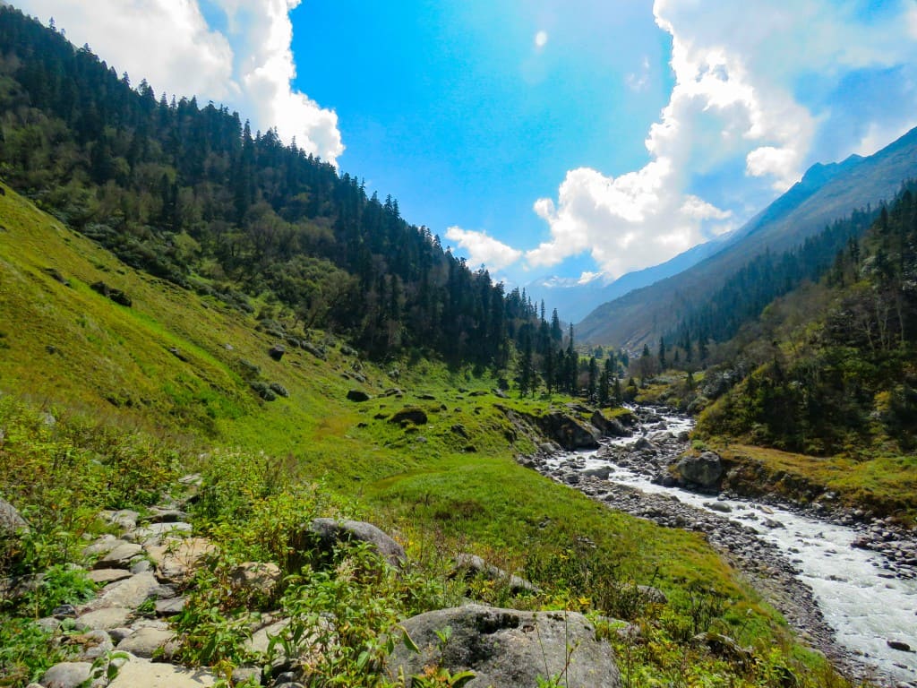
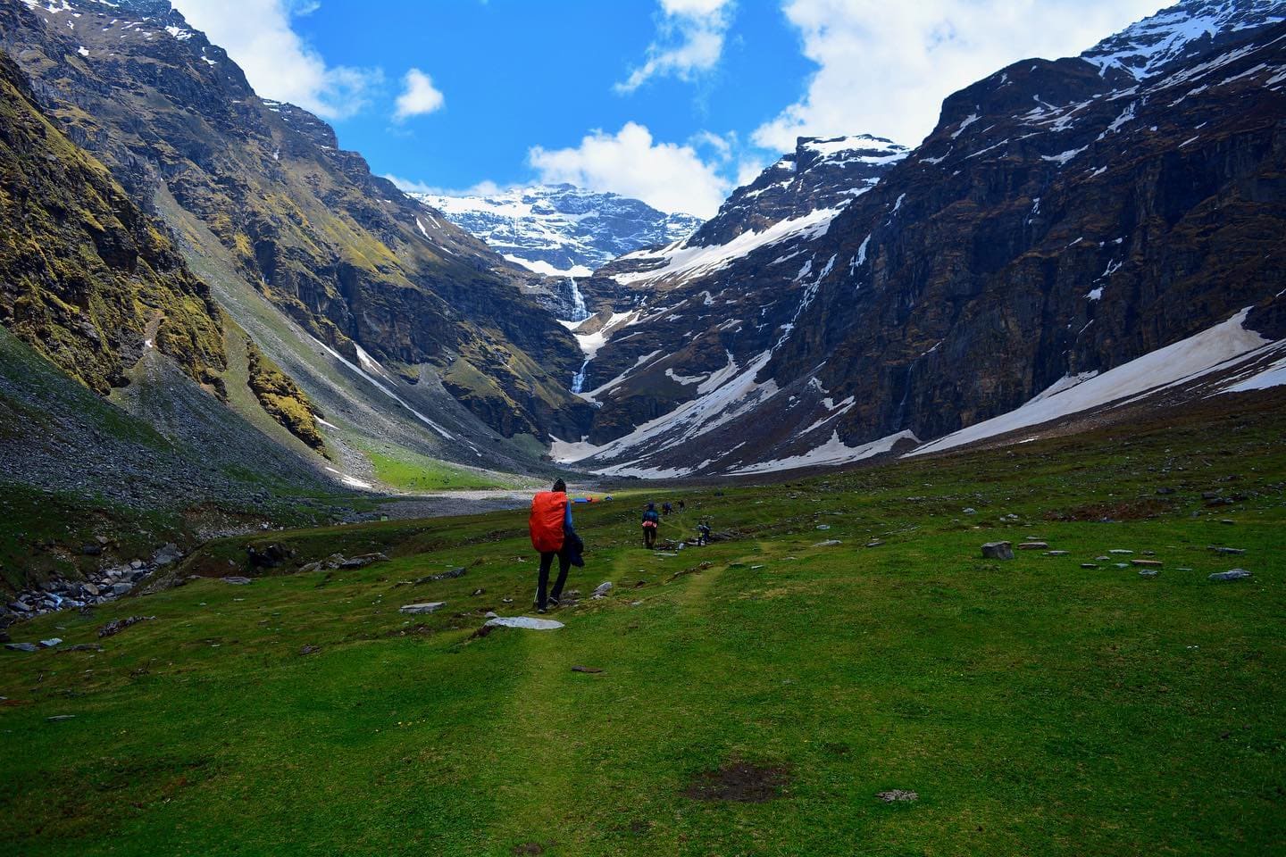
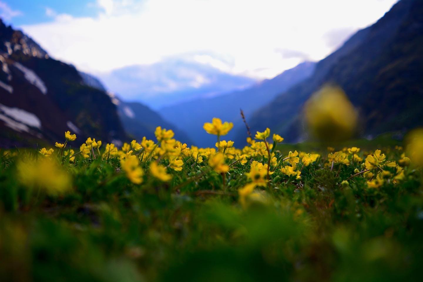
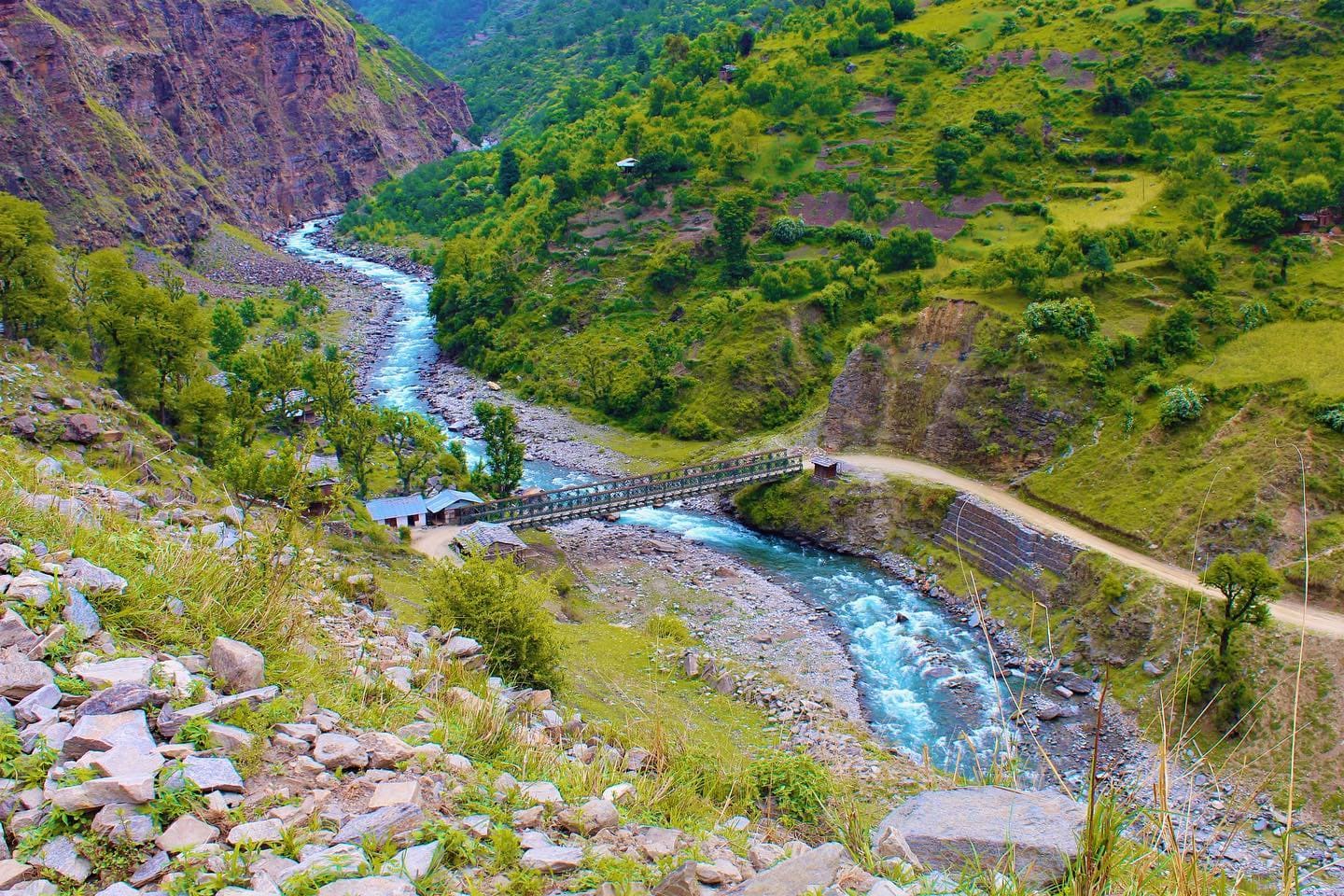
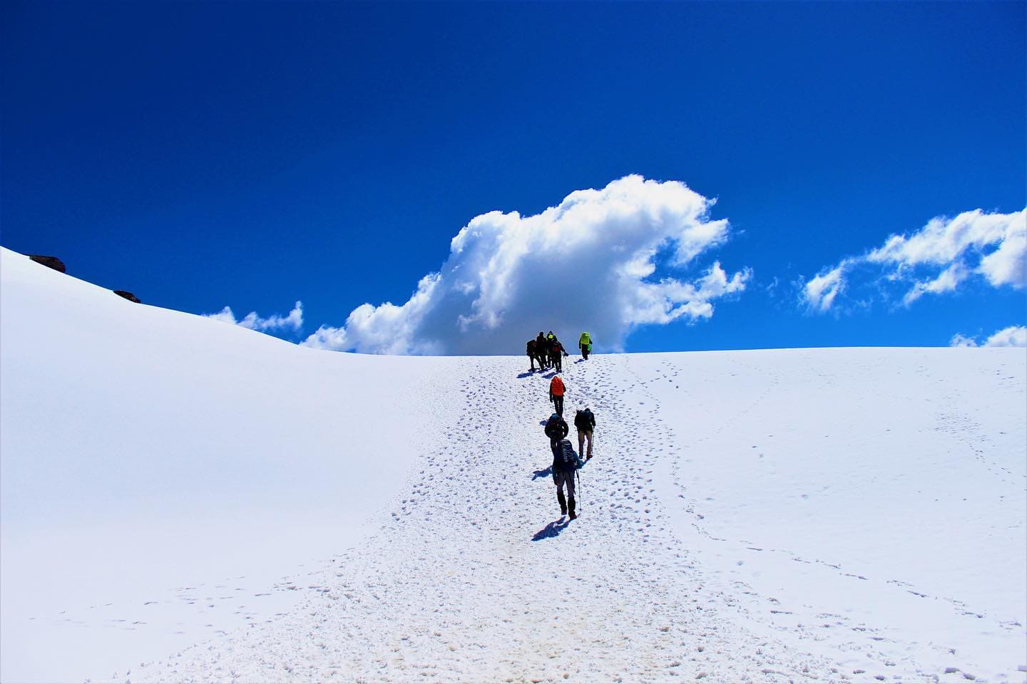
The Rupin Pass Trek is a high-altitude trip that begins in Dhaula in the Indian state of Uttarakhand and concludes in Sangla in the neighbouring Indian state of Himachal Pradesh. The Rupin Pass Trek is regarded to be among one of the high range excursions for trekking in India since it is a high-altitude trip that is around 15250 feet in length. The Rupin Pass walk comprises of pathways carved out of rock faces and wooden bridges. These trails go across snowfields, through glaciers, and along freezing slopes. Rhododendrons that are pure white in colour may be seen dotting the landscape at various points along the path. The Rupin Pass Trek ought to be considered as one of your potential itineraries in the event that you are searching for the most breathtaking hikes that can be taken in the Himalayas. As eighty percent of the trail is located inside Himachal Pradesh proper, you will spend the most of your time hiking in that state. It is one of the range adventures with the greatest altitude, reaching around 15,250 feet. Nonetheless, its prominence is due to more than just its height alone. The fact that the Rupin Pass Trek offers hikers a wide diversity of landscapes and pathways is one of the reasons it is so popular among those who have a deep appreciation for the natural world. You may expect the path to throw something new at you every day. In point of fact, the view changes each time you make a curve on the road. The Rupin River will make an appearance about 20 minutes into the hike and will have spread out onto a broad bed by that point. Throughout the course of the hike, you will also have the opportunity to see a number of waterfalls and streams. The Rupin waterfall is an impressive sight for hikers to take in thanks to its height of 3,500 metres (11,500 feet).
Read More
The sight of hundreds of waterfalls tumbling downhill is sure to be one of the most breathtaking views you’ll ever see. The picture makes it seem as if they are descending from the sky in a straight line. Jhaka Village is another one that takes the cake with its unexpectedly advantageous location. Due to its location at the summit of the mountain, it gives the impression of being suspended from the cliff. When you make your way from Sewa to Jakha as part of the itinerary for the Rupin Pass Trek, you’ll have the opportunity to take in sights like these along the way. After your time in Jakha, you will go to BuransKandi. Snow bridges are another another feature of the path that provides hikers with a sense of diversity. The experience is further enhanced by the presence of dense woods filled with fir, rhododendron, and oak trees. Since they start and stop so suddenly, it seems like you’re in the middle of a movie scene. The tourist industry in the Rupin Pass Trek region has expanded tremendously as a direct result of these beautiful pictures. The two-story Kinnaur Temple in Sewa stands in stark contrast to the landscape that surrounds it. In addition to that, as you reach the finish of the hike, you will be rewarded with breathtaking views of Kailash Mountain. They contribute to the whole of the account that has been told about Rupin Pass. The Rupin waterfall is an impressive sight for hikers to take in thanks to its height of 3,500 metres (11,500 feet). The months of September through November and May through June are considered to be the ideal times to go to Rupin Pass. After passing an elevation of 14,000 feet, the hiker will enter an area where the ground is permanently frozen. At places like this, you should always be on the lookout for little areas of snow, since it may fall at any time of the year. It’s possible that the weather in Rupin Pass during the post-moon season won’t produce snow every time. This is an exceptionally wonderful chance to go via less difficult terrain in the absence of snow. In addition to this, you’ll get the chance to see fall and all of its beautiful hues. This is also the time of day when the weather will be the clearest for you to observe. How can one go to Rupin Pass in the most expedient manner? In any case, the Jolly Grant Airport is located around 25 kilometres outside of the city, so keep that in mind if you want to go by air. If you would rather go by rail, there is a Dehradun to Delhi train that travels through the night. In addition to that, there are buses that run often in that direction. Trekkers will need to have at least a base level of physical fitness in order to complete this journey without encountering any difficulties. The difficulty level ranges from moderate to high.
➩ Itinerary
Distance: 200kms
Time: 11hrs approx
Instead of beginning your tour with a day of hiking, today will be the first day of your trip, and you will travel by car to reach Bawta. As you are travelling, the weather is going to be quite chilly, yet at the same time it will be very humid. Be ready to be awestruck by the stunning vistas of the surrounding hills and environment, which are certain to take your breath away. If you have a passion for the outdoors, don't forget to bring a camera with you since the breathtaking panoramas are difficult to describe in words alone. You will go to Bawta by way of Rorhu on the way there. One may say that Rohru is a town that is located on the Pabbar river. It is around 110 kilometres away from Shimla, the capital of Himachal Pradesh. As you make your way to the basecamp at Rupin Pass, located at Bawta, you go through the Chaaisheel valley. Rather of travelling from Dehradun to Dhaula as specified in the customary route for the Rupin Pass trek, in the past, the road via Chainsheel Valley was a horrific alternative. It has much improved since before. The drive from Shimla to Bawta is one of our favourites. Beginning the hike in such a beautiful and relaxing manner is a wonderful experience. The road from Rorhu branches off into two different paths: the one path leads to Janglik, which is the starting point for the Buran Ghati walk, while the second path leads to Bawta, which is the starting point for the Rupin Pass hike. As we make our way to Bawta base camp, we will be driving through the breathtaking Chainsheel Valley. Here is the route that takes us there. After a lengthy travel of eight to ten hours, you will be provided with delicious meals that are guaranteed to help you restore your strength.
Distance: 5kms
Time: 4hrs approx
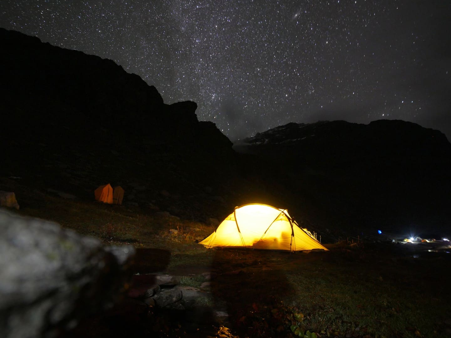
Get up early and go to the mountains to take in the breathtaking view of the sun rising over the horizon. On day 2 of this incredible hike across Rupin Pass, you will pass through the region's highest and most remote town. Since you are going to be hiking for five kilometres, the path is going to be a steady climb for roughly four to five hours. Hence, before you start your hike on the zigzag mixed track, be sure to refuel your body with a nutritious meal. As you are hiking, you will eventually come to a new wooden bridge, and when you get there, you will be amazed at how beautifully a trail like this was carved out of the rock face. Your journey to Jhaka is going to be both exciting and delightful on account of the rapid changes in topography that you'll experience along the path and in the surrounding environment. You will gradually make your way through the mixed thick woodland while following the track that zigzags across it. You will notice as you go through the hamlet of Jhaka that the locals abstain from eating meat because they hold the belief that animals are sacred and thus should not be eaten. Since Selwan Khad is the fourth and last water stop of the day, you will be able to fill up your water bottle here. You will spend the night in tents at Jakha, where during the day you will be able to see nature in all of its splendour.
Distance: 11kms
Time: 8hrs approx
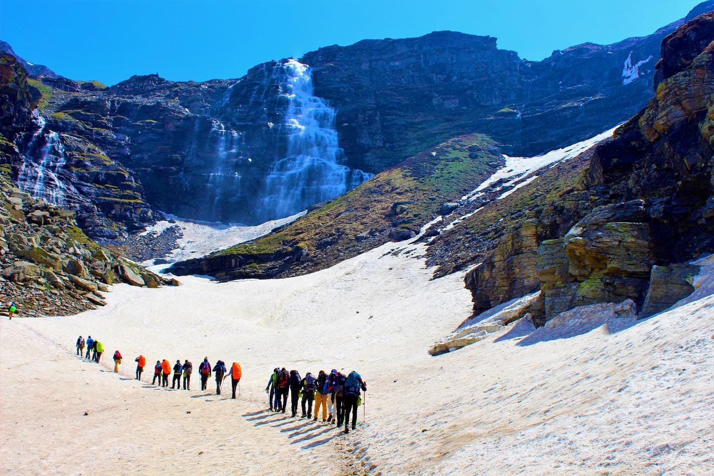
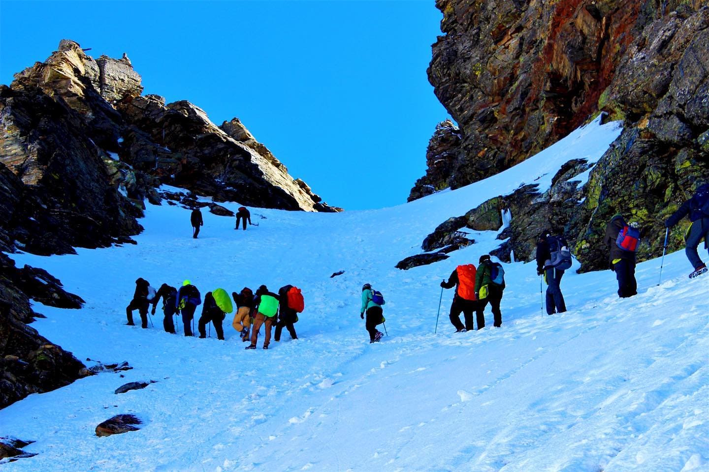
Since the morning views at the Jakha campground are so much more beautiful than you could have imagined, waking up there is certain to be an absolute highlight of your trip. This indicates that the beginning of your day is likely to be filled with a lovely atmosphere. On the fifth day of the hike, you will leave the campground and hike for 11 kilometres in a total of eight hours. You are responsible for transporting meals for the day. The path that will take you to Dhandreyash Thatch will take you through the field, but in the end, it will bring you to a wonderful mountain forest. When you make your way through the woods on the path, you should make a detour to the portion of the hike that is blanketed with snow and offers a breathtaking perspective of the natural world. You are going to come across a snow bridge that will carry you farther over the river Rupin. The winding path that leads out from here will bring you to another picturesque wooden bridge in no time. You should have a fantastic feeling of adventure and excitement at this point because to the river, the landscape, and the environment around you. As soon as you cross streams, you will immediately begin walking on stony terrain and boulders, and the river will be on your left side the whole time. In this manner, you will make your way into another Rhododendron forest that is rather thick and has a variety of various coloured Rhododendron trees. You will arrive at Saurwas Thatch after continuing on your journey for a few more kilometres. Rest here and let yourself to be engulfed by the myriad of stunning hues that nature has to offer. Together with a breathtaking view of the Rupin waterfall, you will also get a glimpse of a peaceful valley in the centre of the forest that is formed like a U. Only if you continue down this path will you reach the point where there is snow on the mountainside. You will be led into the woods by the holy silver cane trees, popularly known as Bhoj Trees. These trees will act as your guides. You will ultimately arrive at the edge of a U-shaped valley as you make your way higher through the woodlands. From this vantage point, you will be able to watch the spectacular views of nature that are certain to leave you startled and also enchant you for a few seconds. We will now make our way lower while passing through the beautiful golden meadows on our way to the valley below. You will arrive in the centre of the Dhanderas Thatch valley after over a number of snow bridges. When you finally arrive, you may unwind and take part in some of the fascinating and enjoyable activities that we have planned for you. You will also get the chance to enjoy and take in the beauty of one of the most well-known and expansive pastures in the Himalayan Range, which is called Dhanderas Thatch.
This day is kept as an extra day due to bad weather conditions to acclimatization in new atmosphere.
Distance: 3.5kms
Time: 4hrs approx
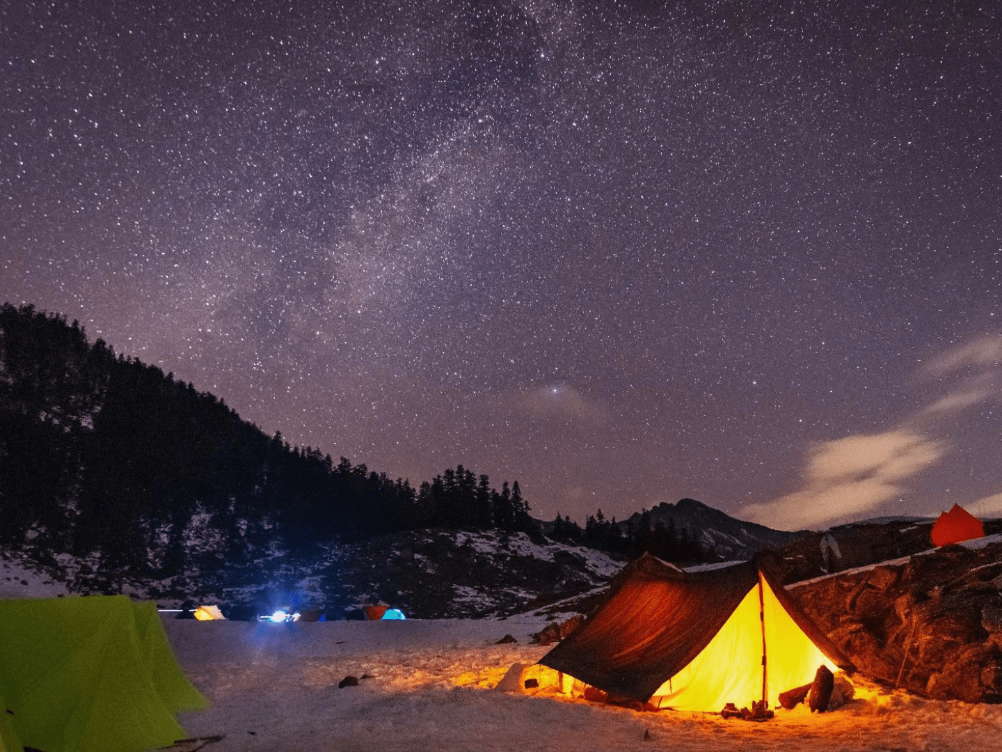
As you first start your hike towards the "Upper Waterfall," the bright yellow blooms of the "Marigold" plant will be blooming in abundance, providing a visual treat that is sure to please. In order to protect you from the effects of the high altitude, we will supply you with the necessary technical equipment and brief you in advance on all of the necessary safety measures. In addition, we are going to provide you with a brief training session in which you will learn all of the skills necessary for snow hiking, such as how to sidestep, slide on snow, and make cuts in the snow. To begin, you will have to use an ice axe to break through the ice in order to get to the bottom cascade. In order to get to the lower waterfall, you will need to traverse a few different terrain features before you can see the breathtaking snow bridge that stretches over the Rupin river. After you cross this bridge, you will find yourself in an engaging setting that will not only give you a burst of renewed vitality but will also astonish you at the same time. It is true that there is a strenuous ascent involved, but once you get to the upper waterfall camp, which is situated at an elevation of 4,100 metres (13,100 feet), you will see that it was well worth it. Don't forget to have a look at the things that are visible from this camp; while you're there, take in the strange beauty and get ready to experience a sense of pleasant pleasure. After reaching this location, you will have the self-assurance and physical strength necessary to continue your journey to the Rupin Pass the next day. Even though day 6 will be exciting and full of thrills, the day after that is going to be even more exhilarating and packed with a lot of action. When you have crossed the bridge, you are free to unwind, have fun, and enjoy yourself at your campground, where you may even prepare supper.
Distance: 9kms
Time: 11hrs approx
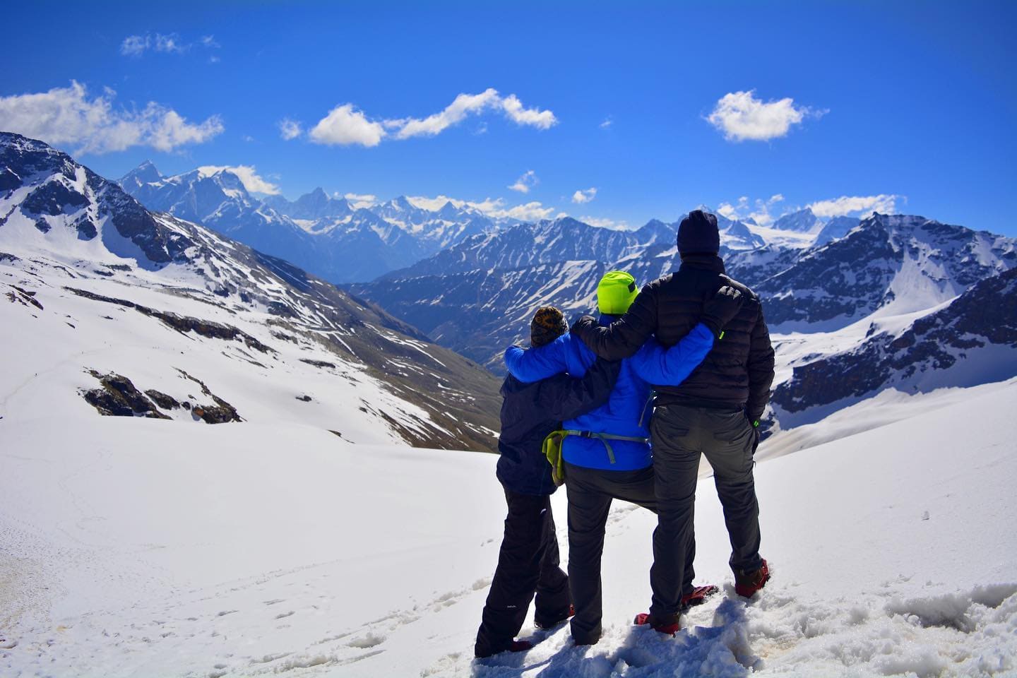
On day 6, you need to make sure that you get up early in the morning since it is going to be a very long day of hiking. You will first be fed breakfast, and then the hiking will get underway. The course on Rupin Pass is incredibly fascinating, and it is something that you will most certainly take pleasure in. Rupin Pass is located at an elevation of 4,650 metres. Be sure to bring along all of the essential camping gear for your hike in order to maximise your chances of returning home safely. Start ascending to Rati Pheri, which is a strenuous ascent, and once you get there, don't forget to take a break for roughly 10-15 minutes since the astonishing changes in nature are a fantastic thrill. This is because you will get to explore so much of nature in just a single walk. When you are making your way across the snow-covered meadow, keep your eyes peeled for the first breathtaking glimpse of Rupin Pass. It's possible that you believe it's impossible to get there, yet hiking up to the pass is an experience that will blow your mind and exceed all of your expectations. Be ready to go through the rocky terrain; there will be loose rocks on the path, and even the stones may fall from above, so exercise caution and make sure to follow the guide's directions to the letter. It is preferable to scale the wall on your own so that you do not have to deal with any form of trouble. The difficult trek may leave you feeling exhausted, but as you reach the top, you will undoubtedly experience an upswing in your attitude. After climbing to the peak, the first thing you will notice is a stunning panorama of the Dhauladhar Mountains, coupled with bright flags that are blowing in the breeze. After having an incredible time on the mountain, it's time to begin making plans for your descent. While descending, you will have a lot of fun as you slide down with enthusiasm until you reach the level track that will take you farther to the meadows of Ronti Gad. Keep in mind that these fields are quite different from the ones that you have seen earlier on in the journey when you are on the walk. The sight of snow-covered mountains and meadows that are growing in their midst is what makes Ronti Gad such a beautiful place to visit, which is why it is a large meadow. After supper, you will go to your tents to get some rest since today is going to be a very long and eventful day.
Trek distance: 12km
Drive: 10hrs approx
The last day of the hike will consist of a descent, but you need to be cautious since the trail's elevation will decrease very rapidly. Today is the last day of the hike. Even if our staff will show you once again how to adjust to these sharp descendants so that you may climb your way downhill in an easy manner without harming yourself, you still need to exercise caution. You need to be aware that the route will begin with a sluggish ascent but will flatten out into a simple stroll as you make your way into the Ronti Gad valley. After ascending a height of around 460 metres (1,500 feet), you will emerge from the congested ravine and be treated to breathtaking views of Mount Kinner Kailash. You will not in any way be able to see the views of the pass from this vantage point. Be ready to go on a journey through the pine forest; at the end of the journey, you will arrive at a town where you will see picturesque apple orchards as well as cottages made of wood. While there are a number of routes that may be taken to get to Sangla from Sangla Kanda, the one that takes you through the forest of blue pines is the one that is recommended. The track comes to an end on a broad and well-defined path that yet descends precipitously to Sangla. After a steep descent that lasts half an hour, you will reach the settlement of Baspa, where you will begin the ascent that will lead you straight to Sangla. The completion of your hike will come about as soon as you reach this point. It is not difficult to go to Shimla from Sangla if you have a private car, even if the route takes approximately nine hours. Make sure that your hotel reservations are taken care of well in advance of your arrival in Shimla to prevent any unpleasant surprises upon arrival.
➩ Inclusion
- 7 days premium trek
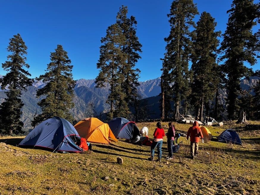
- Double sharing basis of tents through the trek.
- Shimla to Bawta & Return Transport in Tempo/Bolero/Sumo Vehicle
- All meals – vegetarian
- Campfire at Camps (If Available)
Read More
➩ Exclusion
- Pickup from your place
- Luggage carries charges
- Food during travel
- Any kind of personal expenses
➩ Fitness
As you climb to higher altitudes, the air grows thinner and less oxygen is present. The amount of oxygen in our blood is equivalent to the proportion of haemoglobin that is saturated with oxygen. At altitudes above around 2,100 metres (7,000 feet), the amount of oxygen carried by our blood starts to decrease. At the same time, the human body possesses both immediate and long-term adaptations to altitude that help it somewhat compensate for the shortage of oxygen.
Read More
A Great First Trek for Anyone Who Wants to Get Into Hiking:
➩ Safety
Points to remember for safety in the trek:
- It is essential that you arrive at the starting point of any hike or excursion in the best possible physical condition and readiness.
- The hike is not tough; in fact, if you can keep both your feet and your mind calm and strong during the journey, you will discover that the hike is rather simple.
Read More
➩ How to Reach
Directions to go to Shimla:
- By Air: Jolly Grant Airport is the domestic airport that serves Dehradun, and it receives frequent flights from the main metropolises located across India.
- Traveling by Train: The Dehradun junction is the closest railway station, and it has excellent connections to major cities located around India.
- By Road: The road network in and around Dehradun is extensive and convenient. To get to Dehradun from Delhi or any of the other surrounding cities, you have the option of either driving there yourself or hiring a cab or taxi. In addition, there is a consistent bus service between Dehradun and the surrounding areas because to the extensive road network.
➩ FAQ's
The months of May, June, and September are the finest times to trek over the Rupin Pass. But, a little shift in air pressure or a change in the winds might bring precipitation such as rain or snowfall while you are hiking over the Rupin Pass.
The snow at Rupin Pass is renowned for its pristine condition. Snow will greet you as soon as you leave Dhauala and continue your ascent to the Rupin pass. On your hike through Rupin pass, you will ascend to an elevation that is 15,250 feet above mean sea level at its highest point. If you are a fan of snow, you should go to the highest point of Rupin pass since it has the cleanest and clearest snow. Throughout this exciting and unforgettable hike, be sure to transport your snow boots together.
During night, the temperature drops to between 0 and 7 degrees Celsius, while during the day it hovers between in the range of 13-18 degrees Celsius. The weather is unpredictable, making the hike more challenging than it would otherwise be. There is going to be a significant quantity of snow coming from Saruwas Thatch throughout the month of May. The amount of snowfall during June often falls within the average range for this month. September often sees very little snowfall. In the higher levels, the first winter snow will often fall around the first week of October, and it will melt away within a few days after falling.
It is not possible for a first-time hiker to finish the journey to Rupin Pass since it demands them to go for 52 kilometres and ascend to an altitude of 15,250 feet. It is necessary to have prior experience trekking in order to complete the Rupin Pass Trek since the trail to the summit is tough to travel and there is a considerable risk of sliding.
The Rupin Pass Trek may be done without risk of injury. If each and every regulation is adhered to, then the hike has the potential to be the safest hike you have ever experienced. You may easily traverse the rough trails if you are equipped with the appropriate hiking gear, such as shoes and poles. This removes any potential for hazard. When it comes to safety, any hike is potentially hazardous; nevertheless, the level of risk is entirely determined by the conduct of the group as a whole as well as the guide. The Rupin Pass Trek will not be dangerous for you if you have ideal physical and mental strength, follow correct rules, and pay attention to the recommendations given to you by your guide.
In the Indian state of Himachal Pradesh may be found the high-altitude mountain pass known as Rupin Pass. It is located in the Himalayan mountain range. It is situated on an ancient trail used by shepherds and hikers that connects Dhaula in Uttarakhand with Sangla in Himachal Pradesh and travels through the area in question.
The trail across Rupin Pass ranges from moderately tough to challenging. If this is your first time, it is imperative that you get yourself physically prepared at least one month in advance.
The high-altitude walk known as the Rupin Pass starts in Dhaula in the Indian state of Uttarakhand and concludes in Sangla.
You must already possess a certain level of physical fitness in order to do it. If you are a person who is not physically fit and leads a life that is primarily sedentary, then you can also do some form of physical activity such as yoga, exercises, or sports to make yourself fit for the trek every day so that you can properly regulate your breathing.
The Rupin Pass trip alone is perfectly safe. Nonetheless, it is advisable to undertake it in groups considering the tough terrain and weather circumstances.
First and greatest precaution is to overlook or avoid the alcohol when hiking. Clothes must be woollen textiles and no body parts must be visible.
➩ Note
In the normal course of things, IndianTreks anticipates that you will be the one to carry your own personal gear; but, if you want to unload your backpack, you may give it to the mule.
Charge of offloading Backpack
- 2500 INR (Indian Rupees), provided that the payment is made online ten days in advance
- INR 3000/- If you inform us after reaching Bawta.
- There is a need for a waterproof cover on the backpack; luggage and stroller bags are not permitted.
Special offers
- You just need to make one payment, and you may go on the tour as many times as you want.
- If you schedule a trek with Indiantreks and are unable to finish that trek, or if you have successfully completed that journey and wish to do it again, you are free to repeat that trek an unlimited number of times without incurring any additional fees for doing so.
Read More
Terms and conditions To book a trek or an adventure programme, please use our online booking form; if you prefer, you may also give us a call at the number provided. To confirm your reservation, you will need to wire a deposit in addition to the original payment.
➩Trek Departure
6 May - 12 May ( OPEN ) 5 Left
7 May - 13 May ( OPEN ) 7% off
13 May - 19 May ( OPEN ) 10% off
20 May - 26 May ( OPEN ) 11% off
27 May - 2 Jun ( OPEN ) 14% off
3 Jun - 9 Jun ( OPEN ) 13% off
10 Jun - 16 Jun ( OPEN ) 15% off
17 Jun - 23 Jun ( OPEN )
24 Jun - 30 Jun ( OPEN ) 15% off
2 Sep - 8 Sep ( OPEN ) 20% off
9 Sep - 15 Sep ( OPEN ) 20% off
16 Sep - 22 Sep ( OPEN ) 20% off
23 Sep - 29 Sep ( OPEN ) 20% off
30 Sep - 6 Oct ( OPEN ) 20% off
7 Oct - 13 Oct ( OPEN ) 16% off
14 Oct - 20 Oct ( OPEN ) 20% off
➩ Things to carry
PARTICIPANTS MUST BRING FOR RUPIN PASS- TREK
- 50–60 ltrs backpack
- Strong hiking boots: a leather upper is best because it gives your ankles more support. If you don’t have a pair yet, you should get one as soon as possible and wear it a lot so that it breaks in well. This will help keep blisters from forming.
- Tennis shoes or sandals that are light enough to wear in camp
Read More
➩ Why choose us for Rupin Pass Trek
We think that going on outdoor excursions in small groups is the greatest approach to fully appreciate what the landscape has to offer. We don’t leave our urban homes to visit some distant fish monger.
We use a concept called fixed departures to keep the cost of your adventure vacation down. We guarantees all of its clients a departure date regardless of weather or other unforeseen circumstances (known as “Force Majeure”).
We provide very comfortable stay throughout the trek. Proper and good quality tents and sleeping bags are provided with double and triple sharing basis. Tents and sleeping bags are always neat and clean to use.
As a company, Indiantreks is committed to helping people rediscover their personal and spiritual connections to the natural world by encouraging them to put down their phones and other modern gadgets. Connecting with oneself and one’s environment is possible only when one leaves behind all of their cares, concerns, and possessions.
These unspoiled natural settings should remain untouched for future hikers. Leave no trace is our policy to guarantee this (LNT). We take special care to eliminate any traces of our camping activities by properly disposing of waste at each campground. This is one of Indiantreks’ fundamental beliefs.
Indiantreks has taken the Eco-Tourism Pledge, demonstrating our commitment to sustainable practises in all of our operations.
We are firm believers in eco-friendly vacations. As a rule, we prefer to work in remote rural locations where infrastructure has not yet been significantly established. Our mission is to help the residents of these rural areas get the confidence and resources they need to feel like they have a stake
Indian Trek’s team are highly dedicated in safety but as well as giving proper hygenic food throughout the trek. They will not take anything lightly when it comes to good food. Proper washable utensils are using everytime and serving area will also be neat and clean.
₹ 17999/PP
7D - 6N | Shimla to Shimla
- Pickup Time : 7:30 To 8:00Am
- Dropping Time : 7:30 To 8:00Pm
- Pickup & Drop Location : Shimla Bus Station
Need Help Talk to our Mountain Expert
- +91- 7310954451 | +91-7300900108
BE UPDATED FOR THRILLING EXPERIENCES!
Follow Us On
Ask Your Query Here !!
BE UPDATED FOR THRILLING EXPERIENCES!
Follow Us On
➩ Trekker Stories And Experiences With Indiantreks
It was a wonderful adventure, and Indian Treks offered excellent service. The staff members had a wealth of expertise and understanding, such as how to manage large groups and ensure the safety of individual trekkers.
Gauri Walanju


